
Texas Hill Country Chapter
#1410 Boerne Texas
#1410 Boerne Texas
Director's Ride
Director's Ride
Each year since 2003, the Chapter Director has led the Chapter to the Big Bend region to ride some of the iconic Trans-Pecos roads of West Texas. Below are the most common routes our Road Captains lead.
Note. These routes are all terminated at a central location in Alpine but may begin and end at different locations for staging depending on where the majority of Chapter members are lodging for a given year. Road Captains may determine staging, termination, sites of interest, direction of route, and location of stops.
The Big Bend National Park Ride
This ride winds down TX 117 from Alpine to Study Butte into the west entrance into the National Park (a Park Pass is recommended). From the western entrance, the route takes a right turn onto the Ross Maxwell Scenic Drive to Santa Elena Canyon, then back to the Chisos Basin before returning to Alpine. Route length: 273 miles.
[Download the GPX file here] [Download the PDF description here]
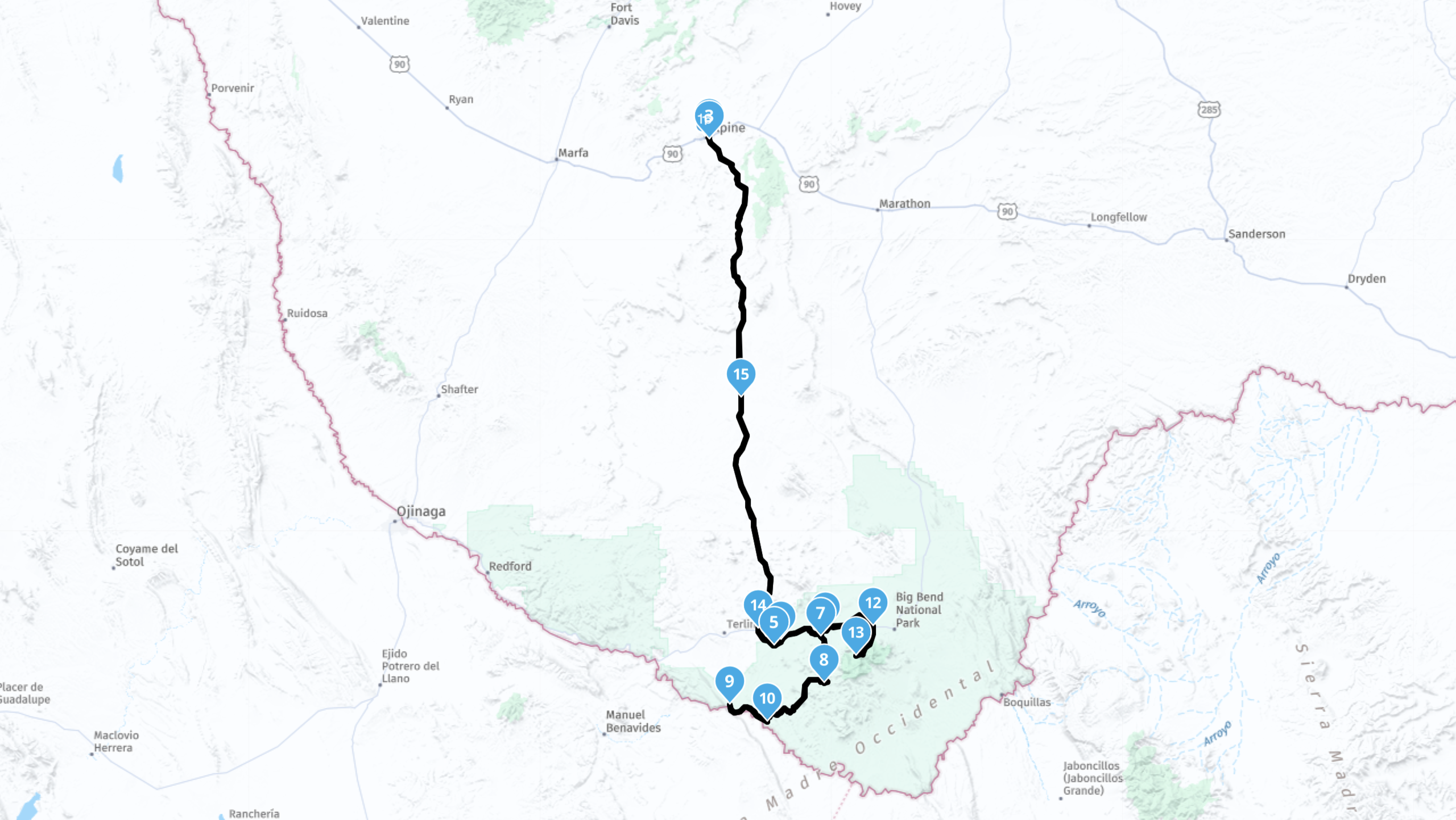
Figure 1. The Big Bend National Park Ride.
The River Road Ride
This route leaves Alpine and heads south (clockwise) or west (counter-clockwise). The clockwise route goes to Study Butte, Terligua, Presidio, then Marfa. This clockwise route typically stops in Presidio for lunch. The counter-clockwise route goes to Marfa, Presidio, Terligua, and Study Butte. This counter-clockwise route typically stops in Terligua for lunch. A video for a portion of the River Road Ride is available on @Rearviews Rides. Route length: 231 miles.
[Download the clockwise GPX file here] [Download the counter-clockwise GPX file here] [Download the PDF description here]
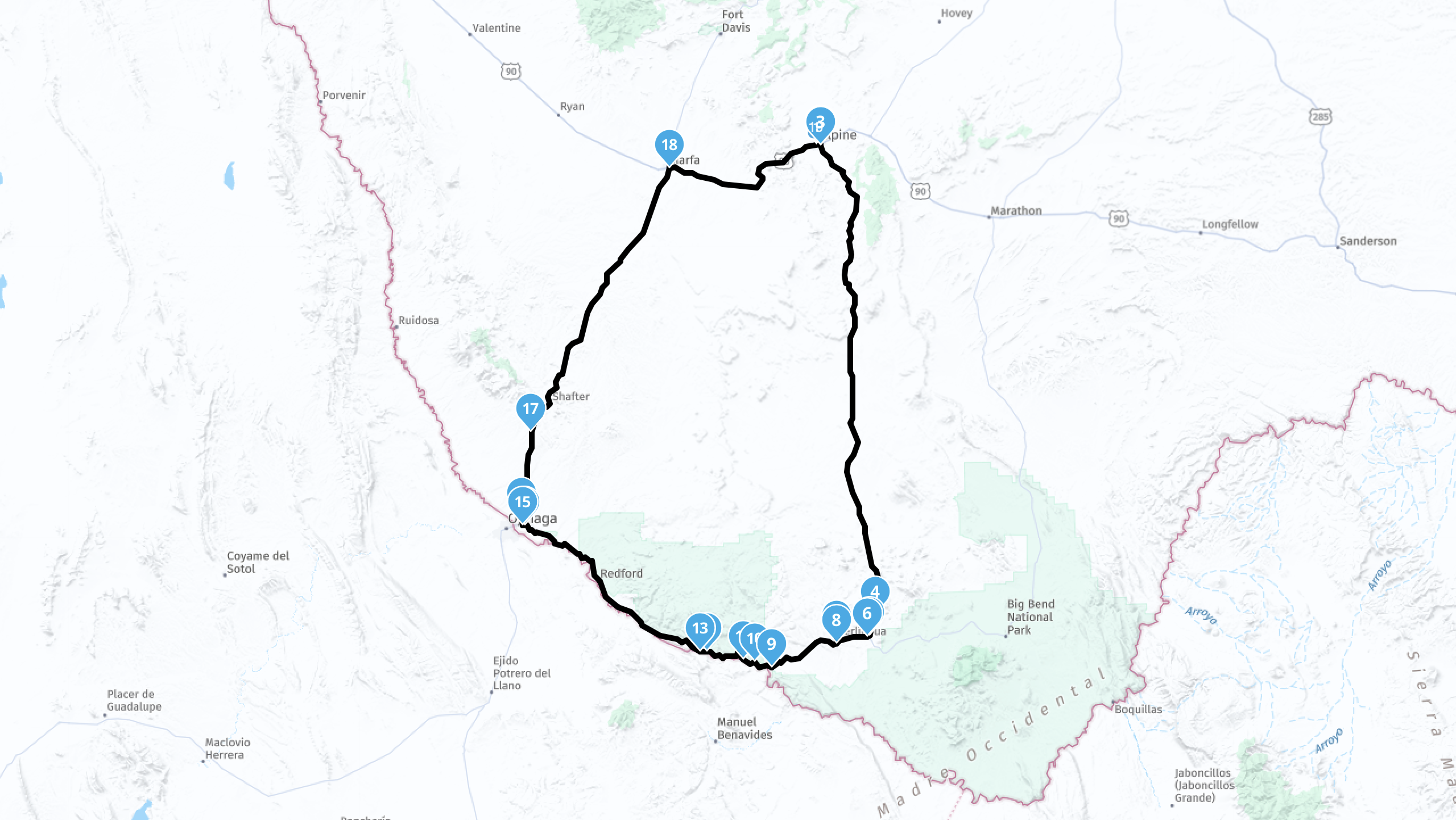
Figure 2. The River Road Ride.
The Davis Mountains Loop Ride
This route heads to Fort Davis and loops west through the Davis Mountains and past the McDonald Observatory. The route then turns south around the range's highest peaks, and east to Fort Davis before returning to Alpine. This route is typically taken counter-clockwise. Both directions are provided below. A video for a portion of the River Road Ride is available on @Rearviews Rides. Route length: 124 miles.
[Download the clockwise GPX file here] [Download the counter-clockwise GPX file here] [Download the PDF description here]
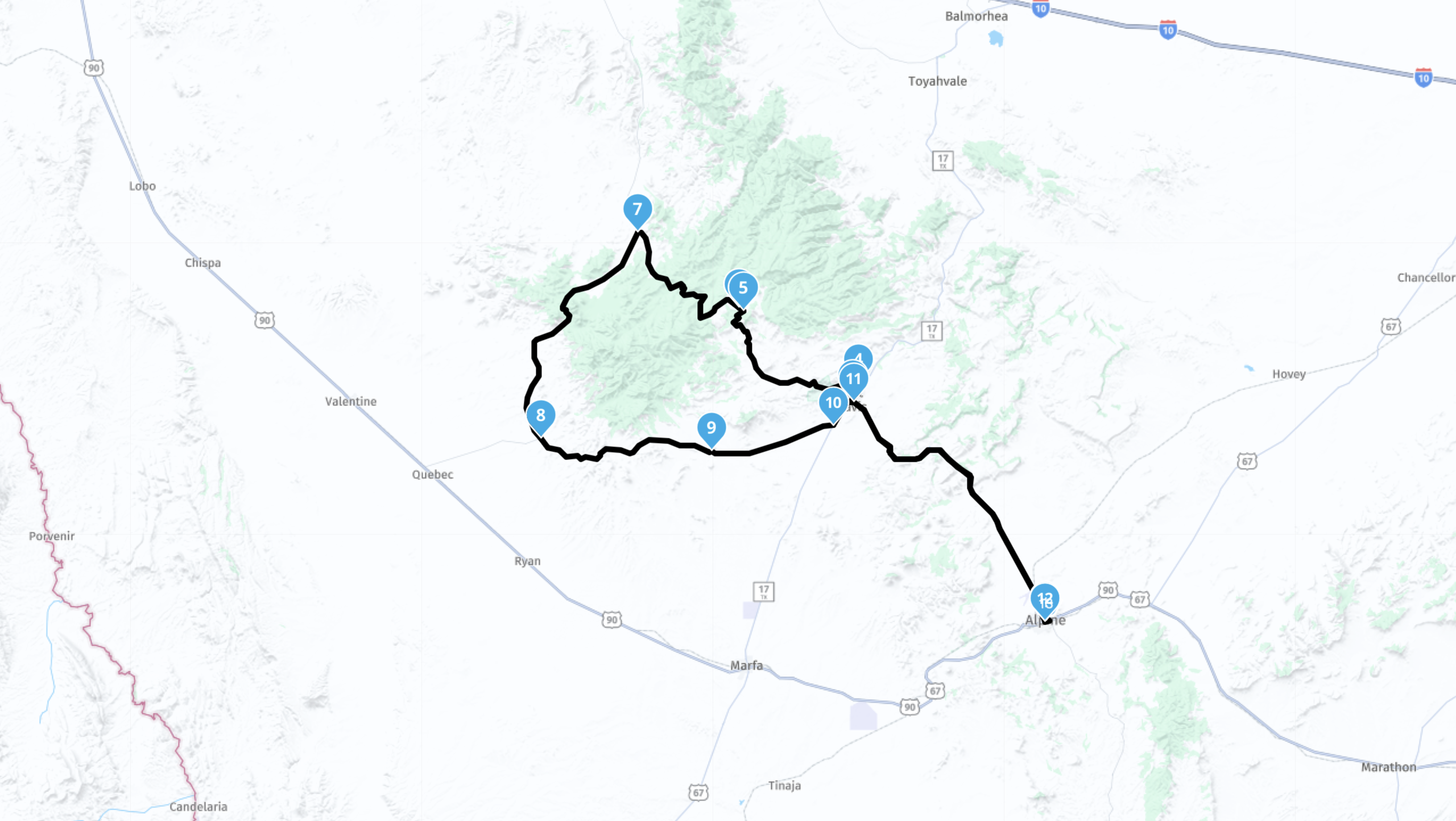
Figure 3. The Davis Mountains Loop Ride.
The Balmorhea Loop Ride
This route heads to Fort Davis and loops west through and around the Davis Mountains to Kent TX, where the route turns east to Balmorhea. From Balmorhea, the route heads south around the east flank of the Davis Mountains, through Fort Davis and back to Alpine. Route length: 172 miles.
[Download the GPX file here] [Download the PDF description here]
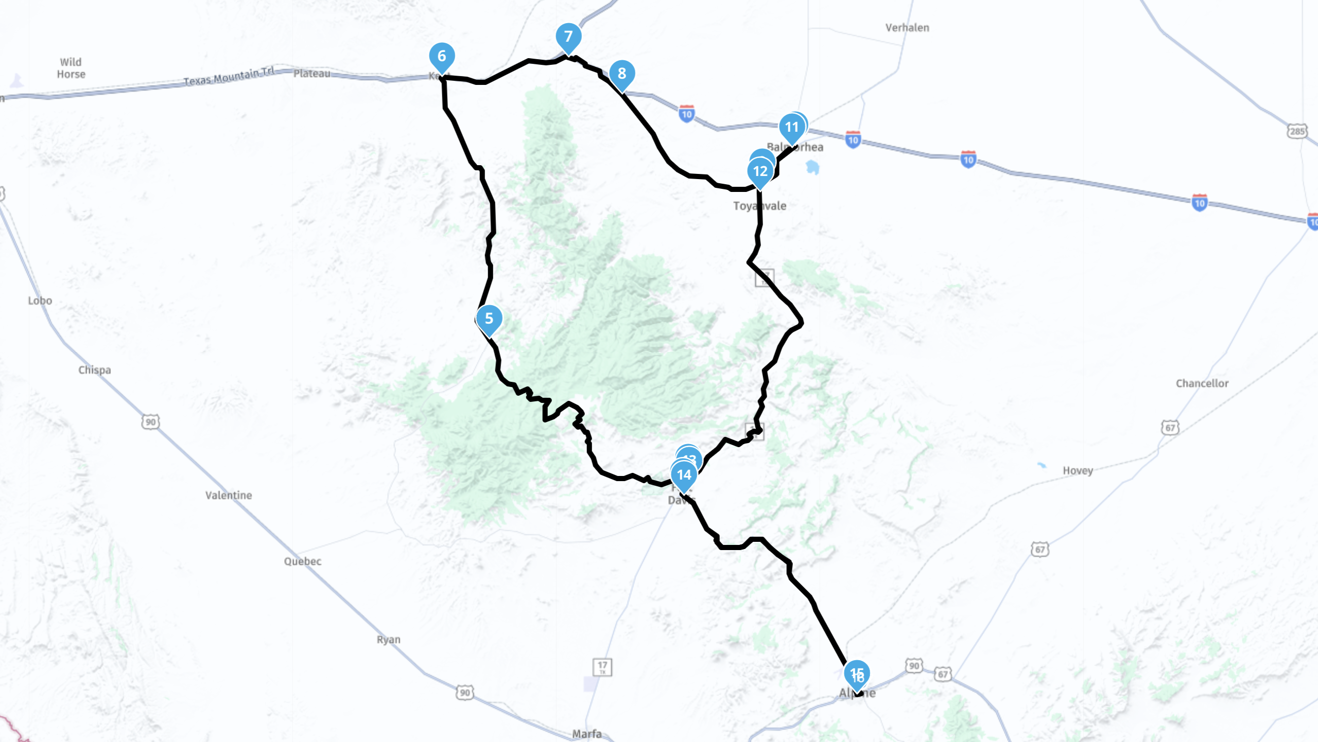
Figure 4. The Balmorhea Loop Ride.
Routes to and from Alpine, Texas stage either in Boerne or Castroville. Both routes converge in Del Rio for heading for the Trans-Pecos across the Pecos High Bridge on U.S. 90. Typical routes are provided below. Both routes terminate at the Dairy Queen in Alpine.
Staging in Boerne
This route to Alpine typically stages at the QT on I-10 at Fair Oaks/Tarpon Dr. Check the HOG Holler for staging time and location for a given year. Route length: 384 miles.
[Download the Boerne to Alpine GPX file here] [Download the Alpine to Boerne GPX file here] [Download the PDF description here]
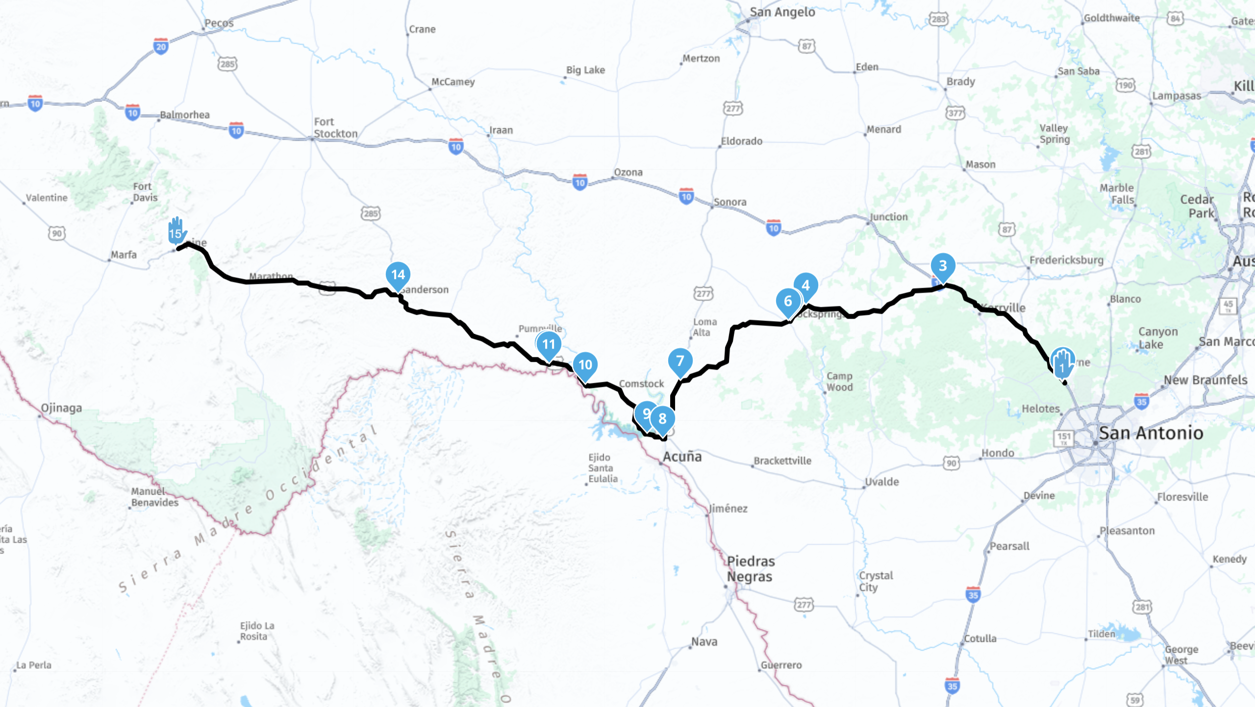
Figure 5. The Boerne to Alpine Ride.
Staging in Castroville
This route to Alpine typically stages at the Shell on U.S. 90 at TX 471 in Castroville. Check the HOG Holler for staging tiem and location for a given year. Route length: 331 miles.
[Download the to Alpine GPX file here] [Download the from Alpine GPX file here] [Download the PDF description here]
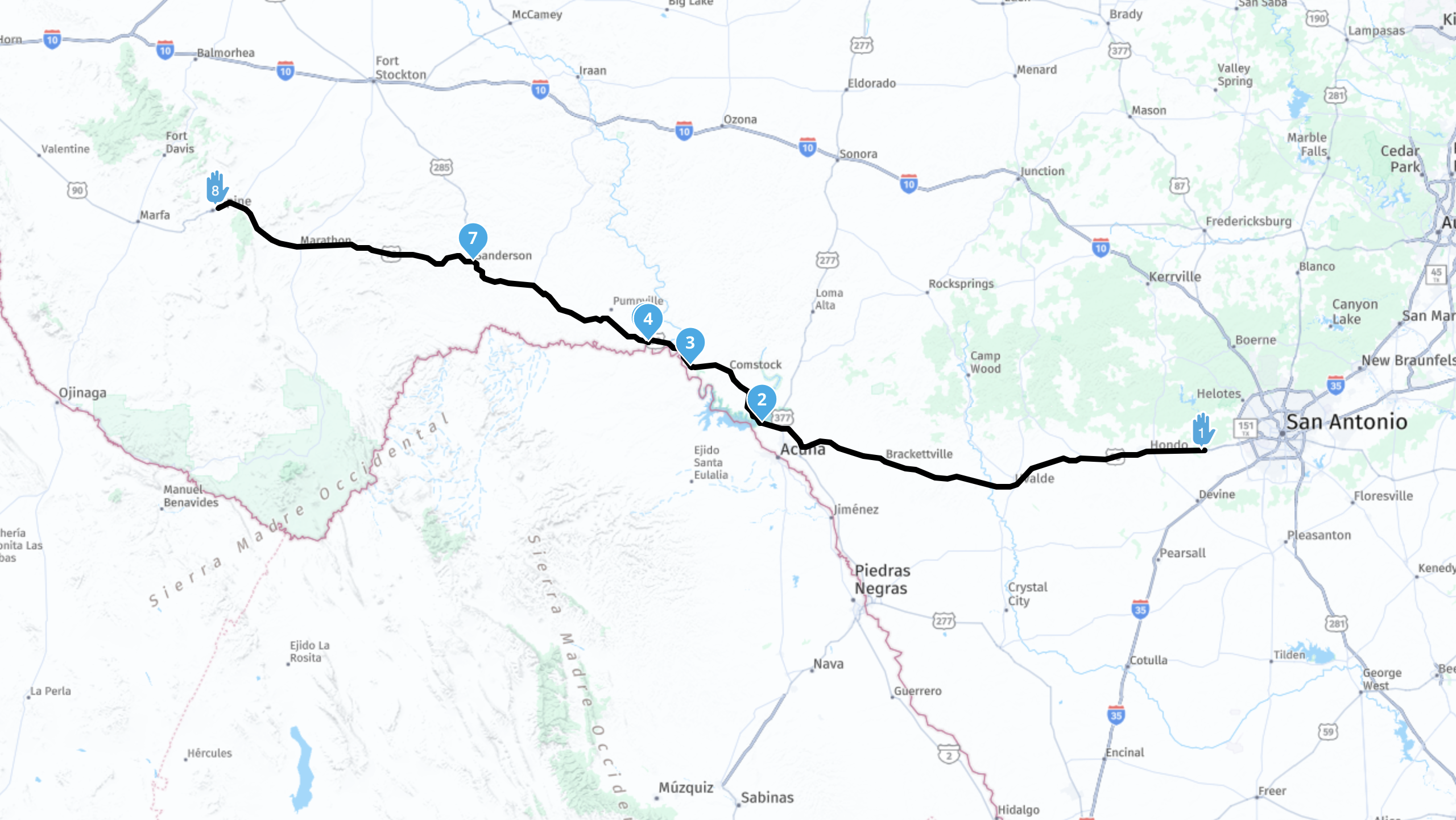
Figure 6. The Castroville to Alpine Ride.
Regular meetings
THCC Chapter meetings are the second Saturday of each month at The Center, 17 Old San Antonio Road, Boerne, TX.
New Member Orientation at 8:30am
Membership meeting at 9:00am
Please check the calendar for updates and changes.

OUR SPONSOR
Javelina Harley-Davidson
29078 I-10 West
Boerne, TX 78006 US
https://javelinaharley.com
(830) 755-5202

Copyright © 2026 - Texas Hill Country Chapter of Harley Owners Group #1410
Privacy Policy